
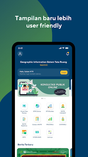
Features Gistaru Mobile
GISTARU (Geographic Information System for Spatial Planning) is the parent GIS application belonging to the Directorate General of Spatial Planning - Ministry of Agrarian Spatial Planning / National Land Agency.
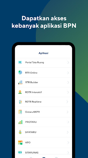
In the mobile version, this application is expected to facilitate the dissemination of information media via smartphone regarding Spatial Planning (RTR) for communities throughout Indonesia.GISTARU has several applications including:1.
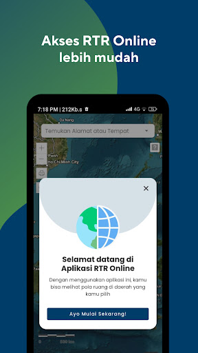
Online RTR which functions to display all RTRs that are Legal,both Space Pattern Plans and Space Structure2.
Interactive RDTR which functions to display the specific RDTR and also the Zoning Regulations.
The map displayed uses the same map as the Online RTR and is used for K-KKPR3.
Realtime RDTR which functions to assist the RDTR revision process and help FPR make decisions4.
RDTR Builder which functions to assist the RDTR preparation process, especially in Preparation Analysis5.
GISTARU - KKPR whose function is to assist the KKPR process, especially KKPR approval for both business and non-business activities6.
Online Public Consultation which functions to help accommodate community aspirations in preparing spatial planning plans.
Gaming Features
Enjoy immersive gaming experience with various game modes.
Parenting Tools
Track and manage your child's development and daily activities.
Smart Home
Control and monitor your home with smart features.
See the Gistaru Mobile in Action
Get the App Today
Available for Android 8.0 and above